INHERITANCE

In the middle of the night, the baby began wailing frantically.

“¡A redo vaya! Good heavens!” Ramona said, sitting up in bed. As she slipped from the blankets, Carlos grunted but didn’t open his eyes. Ramona paused to look down at him, and shook her head. How a man could sleep through that much crying was beyond her comprehension. He must be very tired from the digging he did for the Baldy Mountain miners every day.

As she crossed the room to the baby, she rubbed her ears with her fingers. The Spring wind was howling, which always made them uncomfortable.

She lifted Carlito from his blankets and opened her nightdress. He began suckling eagerly, whimpering a little as he did so, and rubbing his free hand against the side of his head.

So his ears were uncomfortable, too. She looked down at him as she walked the floor, and sighed. He had a lifetime of discomfort before him and there was nothing she could do about it.

from Valley of the Eagles

Book Review: Philmont, A History Of New Mexico’s Cimarron Country

Murphy.Philmont.cover
University of New Mexico Press, Albuquerque, 1972
ISBN: 9780826302441

The summer staff at the Boy Scouts of America Philmont Scout Ranch outside Cimarron, New Mexico are often working their first “real” job. For Lawrence R Murphy in the 1960s, that job became the springboard to a history degree and a master’s thesis on the Baldy Mountain mining district, part of which lies inside the Scout Ranch boundaries. Murphy’s thesis and other writings became the foundation for Philmont, A History Of New Mexico’s Cimarron Country.

But Philmont is much more than a history of Baldy Mountain or Philmont Scout Ranch. It’s also a history of Colfax County, New Mexico.

And it’s a thorough one. The book begins with the region’s plants and animals, then goes on to discuss the Native Americans who were present when the Spanish moved into the area and the uneasy truce and outright conflict between the two groups. It then moves on to the advent of fur trapping in the southern Rockies, the Santa Fe Trail, the establishment and settling of the Beaubien and Miranda Land Grant, and Lucien Bonapart Maxwell’s acquisition of the grant.

This section also covers construction of Fort Union, Cimarron’s role as an Indian agency, the discovery of gold on Baldy Mountain, the Colfax County War, and subsequent events on into the early 1900s.

For a book titled Philmont, this history provides remarkably little space to the actual acquisition and development of the Boy Scout ranch. As a result, its potential readership is far larger than the many Scouts who gather each year at the Ranch. For those of us interested in the history of New Mexico’s Colfax County, including the Colfax County War, it provides a great overview of events.

As a writer of historical fiction who focuses on Northern New Mexico, I found Philmont fascinating and useful as a springboard for my own research. I highly recommend this well-written history of the Boy Scouts of America Philmont Scout Ranch and its region.

U.S. Agency Triggers Colfax County War

On Wednesday, January 28, 1874, the U.S. Department of the Interior issued the order that began New Mexico’s Colfax County War.

The Department had decided to designate the approximately 2 million acres claimed by the Maxwell Land Grant and Railroad Company as public land, not private. This meant that the former Beaubien/Miranda land grant was now open to settlement under federal homestead laws.

The Interior Department’s decision was part of an ongoing dispute over the size of the Land Grrant. According to the Department, until that matter was settled in Federal Court, the land was public and therefore available to qualified homesteaders.

But the Land Grant Company wasn’t about to let anyone settle without payment on acreage they claimed as their own. And that payment certainly wasn’t going to go to the U.S. government.

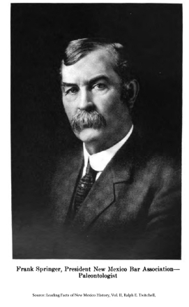
In fact, the Company was already fighting settlers on the vast acreage they claimed. Their attorney, Frank Springer, was hard at work in New Mexico’s Territorial Courts, evicting anyone the Board believed shouldn’t be there. With evictions already occurring, opening the Grant lands to federal homestead claims was simply asking for more trouble.

Jan 28 illustration.Springer, Frank

And it came. If the Company couldn’t get rid of “squatters” through the courts, they’d try other strategies. This all cost money, of course, something that the Board was often short of. But even as the Company teetered on the edge of bankruptcy, its board members continued the fight. If this required extra-legal methods, then so be it.

Right about the time the Department of the Interior announced its decision, another factor arrived in Colfax County. His name was Reverend Franklin J. Tolby. Tolby believed that the Maxwell Land Grant and Railroad Company was taking more than its share of local resources. In fact, he advocated that some of the acreage in dispute be handed over to the Native Americans who’d hunted and lived there long before anyone even thought that American capitalists would have a use for it.

Tolby was articulate and people listened to him. This put him solidly in the sights of the Company’s board members. A lot had happened on the Grant up to this point: legal and extra-legal evictions, miners’ protests in Elizabethtown, meetings of concerned citizens in Cimarron, heated newspaper articles for and against the Grant Company. But none of that compared to what occurred after January 28, 1874. The Colfax County War was about to begin.

By the time it was over, Reverend Tolby and others would be dead, homesteaders would be burned or run out, and the Land Grant Company would be on the verge of yet another reorganization. The grant never did return the profit its investors had hoped for.

As with most wars, everyone got hurt in the end.

Source: David L. Caffey, Chasing the Santa Fe Ring, University of New Mexico Press, Albuquerque, 2014; Moreno Valley Writers Guild, Lower, Lower, and Legends, a history of northern New Mexico’s Moreno Valley, Columbine Books, 1997; Victor Westphal, Thomas Benton Catron and His Era, University of Arizona Press, Tucson, 1973; Stephen Zimmer, editor, For Good Or Bad, People Of The Cimarron Country, Sunstone Press, Santa Fe, 1999.

Every Man for Himself

In March 1867 Larry Bronson, Peter Kinsinger, and R.P. Kelley returned to Willow Creek and the gold they found there the previous fall. Now they were back, even though others were there before them. But even though they weren’t first on the scene, they still managed to do well by themselves, with five 200 foot claims near their original discovery point.

It’s not clear whether anyone had yet contacted the man who owned the land that they were so busily excavating. Willow Creek ran from Baldy Mountain into the canyon of the Cimarron River. All of the land in question was part of the Maxwell land grant owned by Lucien Bonaparte Maxwell and his wife Maria de la Luz Beaubien, whose inheritance it was.

Bronson, Kinsinger, and Kelly took out 14 ounces of gold that summer alone, then contracted for water rights from Bear and Willow Canyons so they could proceed on a larger scale. This involved moving from gold pan mining to hydraulic equipment. With 40 inches of water and 6 inch hoses to spray the rocks out of the hillsides, the company they formed became one of most productive operations on Willow Creek.

In the end, even Lucien Maxwell and his wife did well, partly as a result of the value of the Baldy Mountain area mining. In early 1870, they sold the entire land grant to a consortium of European investors, while retaining key portions of the grant, including mining claims on the east side of Baldy and water rights along Willow Creek. The men who bought the grant seem to have been confident that they also would do well from the gold and silver mines. However, things didn’t pan out quite as they’d hoped. The Maxwell Land Grant and Railway Company was in default by the early 1880s.

But then again, right from the beginning, mining in the area had been based on “every man for himself.”

Sources: Moreno Valley Writers Guild, Lure, Lore and Legends of the Moreno Valley, Columbine Books, Angel Fire, 1997; Larry R. Murphy, Philmont, A History of New Mexico’s Cimarron Country, UNM Press, 1972; Leo E Oliva, Fort Union and the Frontier Army in the Southwest, Division of History, National Park Service, Santa Fe, 1993; J. Rush Pierce, Red River City, JRP Publications, Red River, 2008; 1870 U.S. Census Records, Elizabeth City precinct; 1880 U.S. Census Records, Baldy/Ute Park precinct.


HARVEST

Alison straightened and put her gloved fists on her hips, pushing her shoulders back. Ten two-hundred foot rows of potato plants stretched before her. She twisted her torso, looking behind her and stretching her muscles at the same time. She had dug up the potatoes from about half a row. Full bushel baskets marked her progress. The yield was good this year, but her back was tired already.

She looked up. There were no clouds at the moment, except for a small gathering over Cimarron Canyon. An east wind was starting up, which meant rain at some point this afternoon or evening. She turned in a slow circle, looking up at the peaks surrounding her high Rocky Mountain valley. Snow dusted the tops of Baldy Mountain to the northeast and Wheeler Peak to the west. She went back to her digging. She didn’t have much time.

from Moreno Valley Sketches II

Willow Creek Mining District Reorganizes

On Sunday, August 25, 1867, the miners of New Mexico Territory’s Willow Creek Mining District  organized themselves for the second time that year. They’d done a rush job in June. With miners pouring onto the slopes of Baldy Mountain, there hadn’t been time for organizing and mining too. But it didn’t look like things were going to settle down any time soon: There were up to 7,000 miners in the region, and activity everywhere. On Willow Creek alone, over 350 placer claims would be staked between 1867 and 1868, from high up Baldy Mountain almost to the edge of what is now Eagle Nest Lake. With the staking of claims came the potential for conflict. The only answer was to take the time to reorganize, and Sunday seemed as good a day as any.

The new Willow Creek rules allowed four claims per miner. A man could file a ravine claim (200 feet along the bottom and from bank to bank); a hill claim (200 feet along the stream by 300 feet toward the ridge), a flat claim ( 300 feet by 300 feet); and a quartz or lode claim (300 feet along the lode, with no specified width). In addition, a man who discovered a new creek, hill, flat, or load claim could also file one extra claim of any of the four types. To be considered “alive,” a claim had to be worked one day in every ten and at least once within the 15 days after it was recorded.

The Willow Creek Mining District lay on the south slopes of Baldy Mountain, much of it within the boundaries of the 20th century town of Eagle Nest, NM. The District was bounded on the east and north by the ridges that extended south from Baldy, and on the west by a divide that separated the creek’s drainage from Anniseta Gulch, which ran west in the direction of Moreno Creek and Elizabethtown.

While it never produced much lode gold, the Willow Creek District yielded well to placer operations. In fact, at one point, the main channel of Willow Creek was the highest producing creek bottom along the south and west slopes of Baldy Mountain, topping both Humbug Gulch and Grouse Gulch (see the table below). In addition, a Willow Creek side canyon called Last Chance Gulch and an area at the head of this gulch called Last Chance Flats, were both rich in gold. As a result, the District’s placers brought in 40% of the area’s placer gold in 1868 and 1869 and remained just behind Grouse Gulch’s placer production throughout the next decade.

Aug. 25 illustration.Value of load and placer mining

The high levels of gold from Willow Creek may explain why there were at least twenty miners involved in an 1869 court fight over placer claims and water rights on the creek. The battle was not resolved until Spring 1870, when Lucien Maxwell intervened, purchased all the water rights in question, and then proceeded to lease them back to just a handful of individuals. Even though Maxwell was in the process of selling the land grant, he was keeping the Willow Creek Mining District water rights—perhaps its most lasting wealth—firmly in his own hands.


Sources: R. F. Pettit, Jr. “History of mining in Colfax County, New Mexico,” Taos-Raton-Spanish Peaks Country (New Mexico and Colorado), Northrop, S. A. & Read, C. B., eds., New Mexico Geological Society 17th Annual Fall Field Conference Guidebook, 128 p., 1966; R. F. Pettit, Jr., Mineral Resources in Colfax County, NM, NMBM&MR Open-File Report 15, 1946; Colfax County New Mexico real estate records.


Baldy Town Celebrates the 4th of July

On July 4, 1871, up-and-coming lawyer Melvin Whitson Mills delivered the Independence Day oration at Baldy, the center of gold mining activity on the east side of Baldy Mountain north of Ute Park, New Mexico Territory. The celebrations included a parade of 500 people marching to a grove of trees outside town. There, the local newspaper editor read the United States Declaration of Independence and Mills, the young lawyer and would be politician who had so ably defended serial killer Charles Kennedy a year and a half before, delivered a “spread eagle” oration. A formal dance ended the day.

Although there were those who weren’t impressed that Mills had almost succeeded in rescuing Kennedy from the hangman’s noose, he was respected enough in the county to be elected as a delegate to the Republican National Convention in 1873 as well as various other municipal, county, and Territorial positions. Along with his legal practice and his connections to the Santa Fe Ring, these activities gave Mills the financial ability by the end of the decade to construct a handsome three-story mansard-roofed home in Springer which was known throughout the territory for its more than twenty rooms and its maple interior trim. He also owned a large ranch outside in eastern Colfax County, where he raised cattle and planted the fruit trees that can still be seen in what is now Mills Canyon.

July 4 illustration.Mills house

Sources: Bainbridge Bunting, Of Earth and Timbers Made: New Mexico Architecture, UNM Press, 1974; Loretta Miles Tollefson, The Pain and the Sorrow, Sunstone Press, 2017; Victor Westphall, Thomas Benton Catron and his era, U of Arizona Press, 1973.

HOLLOW

Lucien Maxwell, single largest landowner in New Mexico Territory, stepped from the Middaugh Mercantile porch into early June sunlight and gazed unseeing across the green valley. On the flanks of Baldy Mountain, construction workers scurried like ants around a long wooden aquaduct-like structure. When finished, the flume it held would carry water from the Red River’s source to Baldy Mountain’s base. Then high pressure hoses would spray the sides of the gulches that drained the mountain, flushing out gravel and the gold the miners hoped it contained.

They were calling the flume the Big Ditch. It was a first for New Mexico Territory. Maxwell was a major investor, likely to make a substantial return both from water sales and from men wanting to buy mining rights. Yet all he could see was the letter in his hand.

Kit Carson was dead. Kit, the companion of so many of Lucien’s wilderness adventures, always so full of energy, so confident in his quiet-spoken way, with his sixth sense for trouble and how to meet it. Yes, Kit had been ill, but it was still incomprehensible that he could be gone. Lucien Maxwell gazed at the men scrambling across the hillside opposite and could feel no joy in their activity and its outcomes. It all seemed rather hollow, somehow.


Copyright © 2016 Loretta Miles Tollefson

Baldy Mountain Mining Problems Solved!!!!

May 28 illustration.Big Ditch route map
Source: Red River Museum pamphlet

The miners in the Elizabethtown, New Mexico area were mighty frustrated. There just wasn’t enough water to satisfy their need to wash the gold out of the flanks of Baldy Mountain. They were willing to pay, but there was no one selling. But on May 28, 1868, their problem appeared to be on the way to being solved, because construction began on the Big Ditch.

Designed by a East Coast-educated former Army Engineer Capt. N.S. Davis, the Big Ditch project would employ over 400 men to construct a 41-mile system of reservoirs, dams, and wooden trestles that would funnel Red River’s headwaters to the placer mines on Baldy Mountain’s western flanks. About 7.6 million gallons per day (600 miner’s inches) were anticipated, water enough to supply all the miners in the district.

Or so they thought. The problem was that, as the water sat in the three reservoirs, then flowed through the landscape and the primarily wooden flumes on its 41 mile route to the mines, leakage in the flume and evaporation into the dry New Mexico air sucked much of the anticipated liquid right out of the system. When the water bean to flow the following July, only about 1/6 of the expected amount actually reached its destination. Just over one million gallons a day, or about 100 miners inches, remained for the miners to use.

May 28 illustration.Big Ditch flume

Not only was there not enough water, selling what there was wouldn’t return the $280,000 cost of construction to the original investors. The price of 50 cents per miner’s inch simply didn’t cover the amount invested. The Big Ditch changed hands several times until it was eventually sold to Irish-born Matthew Lynch, who jerry-rigged the system sufficiently to provide for his own hydraulic mining operations and leave a small surplus to sell. So the Big Ditch did turn out to be useful, just not to the level originally projected.

Sources: Red River City, A history of northern New Mexico, J. Rush Pierce, JRP Publications, Red River, NM, 2008; The Leading Facts of New Mexican History, Ralph Emerson Twitchell, Sunstone Press, 2007.


Baldy Miners Organize Themselves

150 years ago today, on May 13, 1867, a group of New Mexico Territory miners met to organize the Baldy Peak/Elizabethtown Mining District. Chaired by John E. Codlin of New Jersey, the committee established the dimensions for lode and placer claims and the amount of necessary to keep a claim active. They also elected a recorder to take responsibility for filing mining, water, and timber rights notices, along with bills of sale and property deeds.

May 13 illustration.placer gold minersThe need for organization was urgent: As many as 400 mining claims had already been staked within an eight mile radius of Baldy Peak.  This included Ute Park, where prospectors Tim Foley, Matthew Lynch, and Robert Doherty had found gold in the bed of Ute Creek, a find that would lead the following year to the discovery of the Aztec Mine, a mine that would produce over $100,000 in gold between October 1868 and July 1869.

Most of the districts placer claims were on Baldy’s western slopes, in gulches that ran from the mountain into Moreno Creek, and in the gravel in the Creek. The mines were concentrated along the lower slopes and along the Creek between Mills Gulch, three miles north of Etown, and Anniseta Gulch, 2 miles south. In addition, there were placers along the upper reaches of Willow Creek on Baldy’s southern slopes, on Ute Creek below the Aztec, and in the upper reaches of South Ponil Creek, near the outcrop of the Aztec vein.

It was only fitting that the 27-year-old New Jersey-born John Codlin should chair the effort to organize all this. He’d been part of the group (with Irishman Patrick Lyons, Prussian-born Fred Pfeffer, and a man called “Big Mich”) who’d first discovered gold at what is now Elizabethtown, a few hundred yards east of the where the town was eventually laid out, in what they named Michigan Gulch. They worked the gulch as the Michigan Company.

Codlin seems to have developed a taste for politics. He would go on to become the chairman of the Colfax County Commission in 1897-98 and to fight the 1897 transference of the county seat from Springer to Raton, a legal challenge that eventually made its way to the Supreme Court, which decided in favor of Raton. He died in April 1908 and is buried in the Springer, NM cemetery.

Source: History of New Mexico, Its Resources and People, George Anderson, Pacific States Publishing, Los Angeles, 1907; Placer Gold Deposits of New Mexico, Maureen G. Johnson, Dept. of the Interior, Geological Survey Bulletin 1348, U.S. Government Printing Office, 1972; Lure, Lore and Legends of the Moreno Valley, Moreno Valley Writers Guild, Columbine Books, 1997; Philmont, A History of New Mexico’s Cimarron Country, Lawrence R. Murphy, UNM Press, Albuquerque, 1972; Familysearch.org; 1870 United State Census Data, Colfax County, New Mexico.