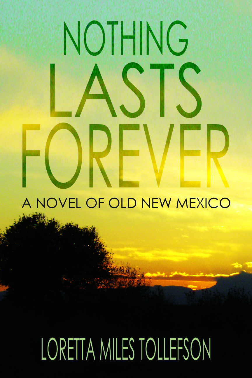
I am pleased to announce the publication of Nothing Lasts Forever, my latest Old New Mexico novel and the fourth volume of my Locke Family Saga series.
This book continues my emphasis on deeply researched historical fiction set in mid-1800s New Mexico and finds Alma Locke in Taos in late 1846/early 1847. Here’s the book description:
On Thursday, January 19, 1847, long-simmering tensions erupted in bloodshed in Taos, New Mexico, brought to a head by the recent American takeover during the Mexican American War. Within 24 hours, almost all the Americans in Taos were dead, including Governor Charles Bent.
The insurrection was eventually crushed by American forces in a final battle that destroyed the Taos Pueblo church. The trials that followed are renowned for their biased juries, foregone conclusions, and speed of execution.
Nothing Lasts Foreverexplores the tensions that fed the 1847 rebellion from the point of view of the fictional Alma Locke, in Taos to bury her mother, and Governor Bent’s five-year-old daughter, Teresina.
A heartbreaking novel of love, loss, and conflicting loyalties, Nothing Lasts Forever explores the personal conflicts behind the rebellion and how two families coped with their losses and struggled to make sense of unimaginable tragedy.
Although this is Book 4 of the Locke Family Saga, it can be read as a stand-alone novel.
In a recent post about the Santa Fe plaza, I included a set of maps. If you look closely, you’ll notice that even the oldest of them identifies a small building on the south side of the square as the “military chapel.”
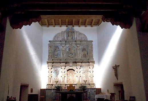
More properly called the Military Chapel of Our Lady of Light, and commonly referred to as La Castrense, this building was centered in the buildings on the south side of the Plaza and faced the Governor’s Palace on the north. The word Castrense means “belonging to the military profession,” so its nickname was appropriate, because the little church was built specifically for use by the members of the Santa Fe garrison.
The original chapel was completed in 1717 and then rebuilt and rededicated in 1761. The reconstruction was funded by Governor Francisco Antonio Marin del Valle and his wife, Dona Maria Ignacia Martinez de Ugarte. This power couple also donated a new altar piece, or reredo, which was carved from large pieces of limestone quarried north of Santa Fe near Pojoaque. Said to be the largest and most ambitious piece of artistic work ever attempted in New Mexico to that point, the piece filled the entire altar end of the building.
La Castrense altar piece today, courtesy El Cristo Rey Catholic Church, Santa Fe
The chapel received further decorations around 1813, when Pedro Bautista Pino, New Mexico’s representative to the Spanish Cadiz, returned from Europe with two marble bas-reliefs which were mounted on the outside wall above the door from the plaza. Colonel Francisco Perea remembered years later that one of them represented “Santa Gertrudes wrapped in the coils of a large serpent, while the other, I believe, represented the mother of Jesus, Nuestra Senora de la Luz (Our Lady of Light), recuing a human being from Satan.”
The military troops stationed in Santa Fe attended services in the chapel monthly as well as on special occasions. During Governor Manuel Armijo’s first two administrations, he and the full garrison attended regularly, with the officers in full uniform. However, it seems unlikely that they continued to do so during his third term (July 1845 to August 1846) as the roof had fallen in. At least, that’s what Lt. James W. Abert reported in early October 1846. He also said the building contained “some handsome carved work behind the altar,” and that at least one of the bas-reliefs still remained over the door, the one that showed Our Lady of Light.
Abert had entered Santa Fe in the Fall of 1846 with the occupying U.S. army. Five and a half years later, in Spring 1851, newly appointed Chief Justice Grafton Baker, needed a place to hold his court and decided to use La Castrense.
The building, apparently repaired by this time, was set up with the necessary furniture and the grand jury was called. Unfortunately for Judge Baker, the grand jury members included Santa Fe native and former Mexican soldier, Donaciano Vigil. Vigil and his wife had been married in the chapel, and his father and an infant son were buried there. As former provisional governor under the U.S. rule, he had enough political clout to risk protesting the use of the chapel for civil purposes and enough connections in the city to rally public opinion behind him.
Baker threatened to hold court anyway and to have Vigil arrested, but when a crowd began to assemble outside and the commanding officer of the American troops rallied behind Vigil, the Judge gave way. He ordered the court moved across the plaza to the Governor’s palace. The men responsible for shifting the furniture didn’t have to actually remove it from the building. The crowd had already dumped most of it in the plaza.
The building doesn’t seem to have been immediately converted back to being a chapel. According to the 1891 Silver City Enterprise, in the 1850s, it was instead used to store captured cannons, including the Lone Star of Texas which had come into New Mexico in 1841 with the ill-fated Texas Santa Fe Expedition.
The guns must not have stayed there for long, because in 1859 Bishop Lamy exchanged the building for $2000 and land in the vicinity of the Parish church. The money went to repairs for church and the land became the site of St. Michael’s College and the Loreto Chapel.
La Castrense itself was demolished by its new owner, but not until the altar piece was preserved and carefully removed. It is now in El Cristo Rey, which offers a brochure about the reredos on its website. It’s nice to know that, even though the building itself had to give way to “progress,” at least some of its contents were preserved and still survive.
Sources: James W. Abert, Western America in 1846-47; https://www.cristoreyparish.org/; Roland F. Dickey, New Mexico Village Arts; Francois-Marie Patorni, The French in New Mexico; Colonel Francisco Perea in Allison, “Santa Fe in 1837-1838”, Old Santa Fe Magazine, Vol. II; Silver City Enterprise, Oct. 9, 1891; Marc Simmons, Spanish Government in New Mexico; Francis Stanley, Giant in Lilliput; Maurilio Vigil and Helene Boudreau, Donaciano Vigil.
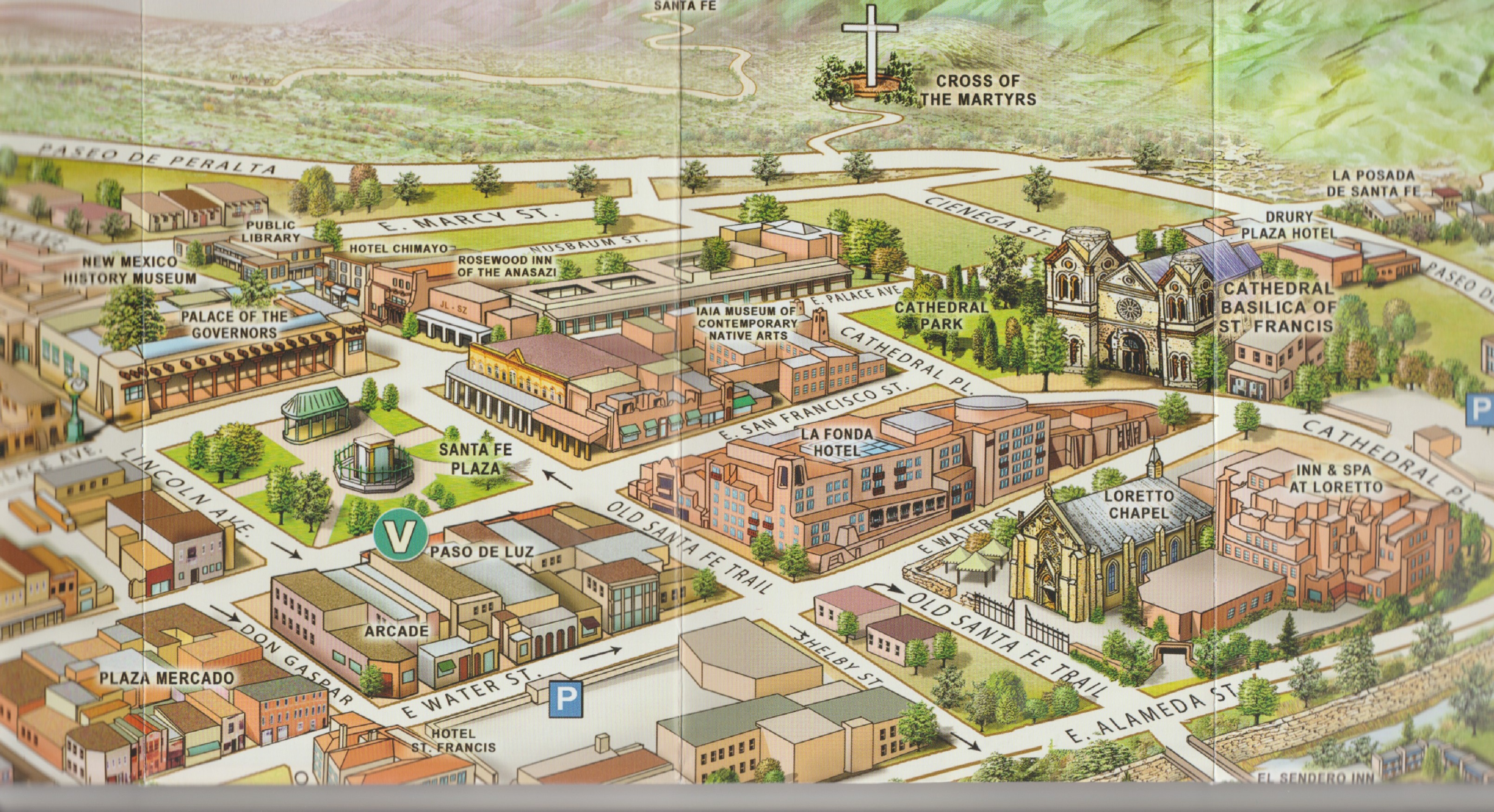
When the Spanish settlers created the Santa Fe, New Mexico plaza in 1610, it was roughly twice the size it is today, even though they didn’t have sufficient buildings to surround it. That would come later. Certainly the newcomers had high ambitions for their new town “square.” We can see from the map created by José de Urrutia about 150 years later that it extended from the church (la parroquia) to about where the western boundary is today.
The plaza was laid out in an approximate ratio of 2 to 3, width to length, as prescribed in Spanish law. It had a number of uses—military drills, mustering livestock, small-scale trading, and general commerce, as well as social and public events. Although there’s no sign of it on the 1776 map, in the early 1600’s an acequia ran along the north side.
The acequia may have been used to water trees in the plaza. We have written documentation of at least two plantings, one prior to 1837, when Jose Francisco Perea tells us there were three cottonwoods “of the mountain variety” in what was then the northeast corner. In the mid-1840s, Governor Mariano Martinez had more cottonwoods put in, although we don’t know what type. By the time he was done, trees circled the square and additional ones had been placed along the Santa Fe river.
The square had shrunk considerably by then, to the size it is today. The 1846 map created by U.S. Corps of Engineers Lts. W.H. Emory and J.F. Gilmer reveals that the eastern half of the plaza had been filled in with buildings by that point. It had apparently been this shape for at least the last ten years. Jose Francisco Perea tells us it hadn’t changed much during that period, except for the new trees. And the fact that the square was now seldom used as a camping place and stock corral.
According to James Josiah Webb, in the 1840s the northeast corner of the plaza contained the old Mexican customs warehouse. The eastern side of the square was lined with government buildings and anchored at the southern end by a store run by Don Juan Sena.
The Pino family lived across the street, on the south side of the plaza, alongside a couple more stores, including the one rented by Leitensdorfer and Company. The crumbling adobe military chapel lay in the center of this row of buildings.
The west side of the plaza was nearly all residences, except for the old Mexican post office, and the north side was defined, as it is today, by the long low adobe structure that had been there since the beginning. The compound it fronted had served over the years as a fort, barracks for the Presidio troops, local jail, housing for the civil governor, treasury, and other functions.
Known as “el palacio” by the locals, the Americans retained the building’s basic functions after they invaded in 1846. By 1857, it included the chamber for the territorial legislature, offices for the Secretary of the Treasury and Superintendent of Indian Affairs, the post office, and (still!) the calabozo, or jail.
The building, which is still called “el palacio,” has been renovated a number of times, most recently a few years ago, and now anchors the New Mexico History Museum. It’s well worth a visit if you happen to be in town. As is the plaza. It changed once again in the 1860s, when a bandstand was added, along with walkways that crisscrossed the space. This layout has been retained ever since then. You can see it in the birds-eye view map from 1882 as well as the current map.
As you can see from the map, the plaza in Santa Fe is still walkable. Trees still shade the paths, and there are still small-scale traders, most often now only under the palacio house portal. It’s the perfect place to spend a few hours on Sunday afternoon or any other time.
I normally review books set in or about New Mexico in the 1800s, but I couldn’t resist sharing In The Shadow of Sunrise by Jennifer Bohnhoff with you. This novel tells a story from a much earlier time frame—the Folsum Culture period about 9,000 years ago. So it’s definitely a trip back in time.
And it’s a really special trip. This is one of those stories that linger in your mind long after you’ve read it. Its protagonist is a young man named Earth Shadow, who is physically handicapped and feels inferior to his stronger twin brother, Sunrise. As the boys join the healthy adults of their clan for the annual migration to hunt and meet other groups, Earth Shadow must come to terms with his physical handicaps and learn that his mental capabilities give him a capacity for leadership that his brother will never have.
Although this book is written for middle grade readers, its characters and situations make for fascinating reading for adults, as well. Bohnhoff does an excellent job of presenting her meticulous research in a way that informs but never gets in the way of the story and its characters. I highly recommend In The Shadow of Sunrise to audiences of all ages.
You can find a free teacher’s guide and special rates for class sets at jenniferbohnhoff.com/in-the-shadow-of-sunrise.html.
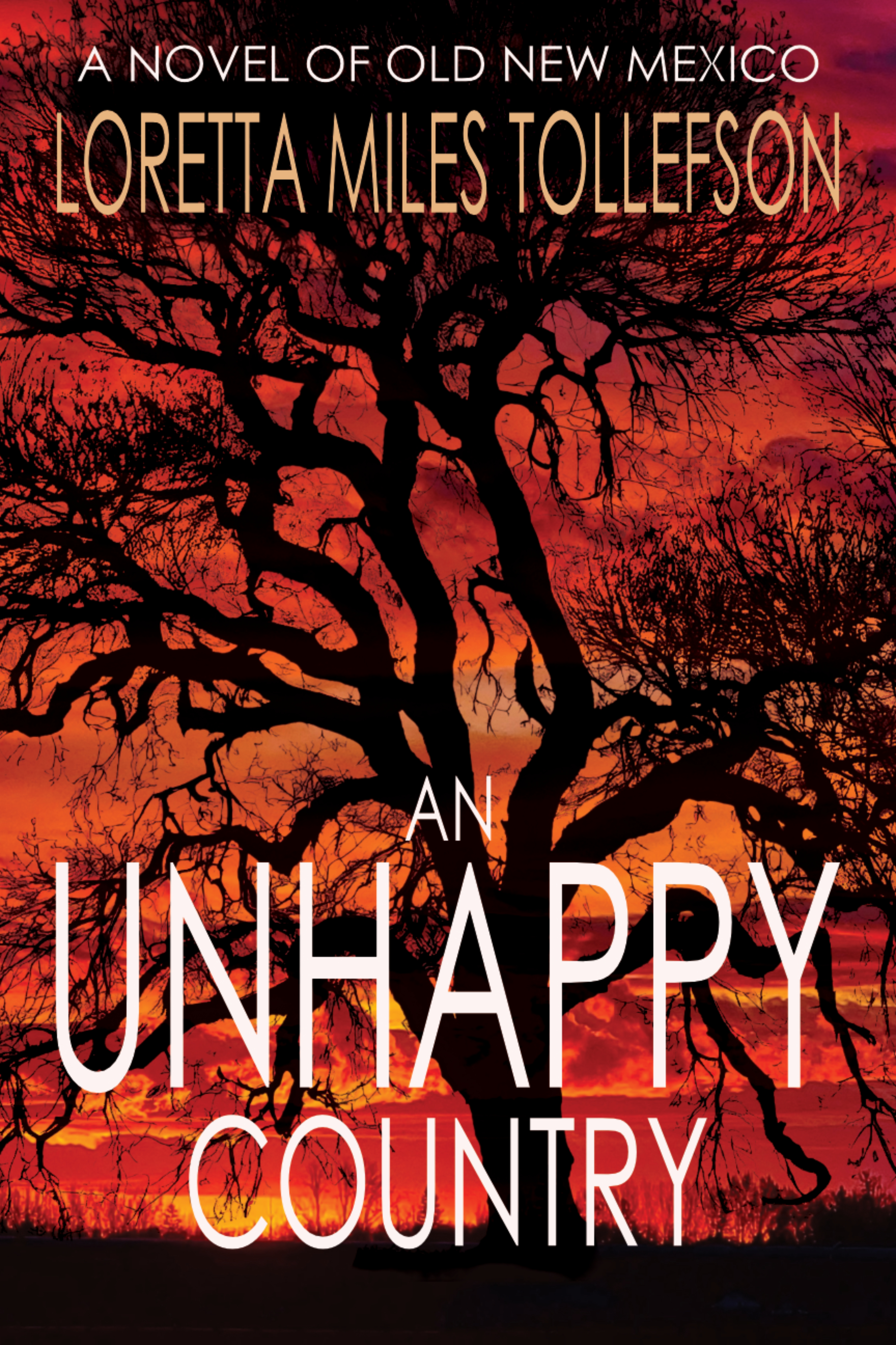
The thirty-day countdown to publication of my novel An Unhappy Country has begun!
It’s August 1846. The U.S. army has taken Santa Fe without firing a shot. The Mexican American War is over in New Mexico. Or is it?
Two days after the Army arrives, seventeen-year-old Jessie Milbank and her friends stumble on a man with a knife in his back in the Santa Fe plaza. Then someone close to Jessie’s friend Juanita is murdered. When an insurrection is suppressed in December, Jessie begins to wonder if the three events are linked.
Were the murdered men part of a conspiracy to throw out the invaders? And were they the only ones hoping for a fight? After revolt does finally break out and the Americans suppress it at the battle of Taos Pueblo, yet another man is murdered. Will the reasons for his death provide clues to the earlier ones?
Early readers are raving about Jessie, the book’s insight into these little-known events, and the beautiful writing in this novel.
The name “Taos” conjures many things. An ancient pueblo. A Mexican outpost. Gringo mountain men. A violent revolt. A funky 21st century village. But the village and pueblo are two separate places. There are Spanish villages and Indigenous pueblos side by side all over New Mexico. As far as I know, only in the Taos valley do the two settlements carry the same name.
And where does the name come from and what does it mean? Now there’s a question. According to F.R. Bob Romero in Santistevan and Moore, Taos, A Topical History, it’s been attributed “to an Indian word meaning ‘Red Willow’ or ‘people of the Red Willow.’” But no one knows for sure. All we know is that it’s what the pueblo was called after the Spanish arrived. Romero says it’s likely a “Tiwa Indian term that perhaps began with the T sound and was Hispanicized as Taos.”
So that explains (or doesn’t!) that. But then there’s the question of the name of the village which is three miles southwest. We call it “Taos,” but it was originally called Don Fernando de Taos, San Fernando de Taos, San Fernandez de Taos, and various forms of these three names, such as Don Fernando, San Fernando, San Fernandez, or simply Fernando or Fernandez. Although the latter two don’t appear very often in the historical record. Even then, if the name is shortened, it becomes simply “Taos.”
As far as I know, Don Fernando de Taos is the only location in New Mexico which has the honorific “Don” attached to it. The Don Fernando for whom it was named was actually a Don Fernando Durán y Chávez, who had a hacienda near Taos Pueblo in the late 1600s. He and his son fled south during the Pueblo Revolt of 1680 and didn’t return. In 1795, the grant was ceded to settlers from the nearby Cañon area, but the village didn’t really start to thrive until French-Canadian and American mountain men [post link here] began to trickle in in the 1820s.The village was a restocking and trading point for the fur trappers. Some of them stayed to set up mercantile businesses and intermarry and the community became the center of americano settlement in the valley.
Ironically, the location that developed in response to the American presence became the flash point of resistance to the 1846 American invasion. Maybe the locals just got sick of us.
Sources: Source: Francis L. and Roberta B. Fugate, Roadside History of New Mexico; Robert Julyan, The Place Names of New Mexico, Revised Edition; F.R. Bob Romero in Santistevan and Moore eds., Taos, A Topical History; http://taoscountyhistoricalsociety.org/taoshistory.html, accessed Jan 3, 2017
I’m pleased to announce that my Old New Mexico novel An Unhappy Country will be published in April 2025. A murder mystery, this novel is set during the Mexican American war and focuses on events in New Mexico, which was invaded by the U.S. Army in August 1846. It features Jessie Milbank, an American merchant’s daughter who can’t leave well enough alone. Here’s the book description:
August 1846. The U.S. army has taken Santa Fe without firing a shot. The Mexican American War is over in New Mexico. Or is it?
Two days after the Army arrives, seventeen-year-old Jessie Milbank and her friends stumble on a man with a knife in his back in the Santa Fe plaza. Then someone close to Jessie’s friend Juanita is murdered. When an insurrection is suppressed in December, Jessie begins to wonder if the three events are linked.
Were the murdered men part of a conspiracy to throw out the invaders? Were they the only ones hoping for a fight? After revolt does finally break out and the Americans suppress it at the battle of Taos Pueblo, yet another man is murdered. Will the reasons for his death provide clues to the earlier ones?
My novel The Pain and the Sorrow is on sale through Friday, November 22. The ebook is $.99 and is available in Kindle and other formats. The paperback (available through Amazon) is $10.99.
At the foot of a lonely mountain pass between Taos and Elizabethtown, a single log cabin huddles under the pines. Travelers are invited inside to stop, rest, and eat.
But they should be careful how they look at the young woman who serves them. Her husband, Charles Kennedy, is subject to jealous rages. At least, he says that’s why he kills the unwary: It’s all Gregoria’s fault.
David Caffey’s recent book When Cimarron Meant Wild fills an important gap in the historiography of northeast New Mexico, specifically Colfax County, a.k.a. Cimarron Country. There are a number of books available about different aspects of the county and the personalities that made it legendary in its time, but up to this point, none of them have tied everything together, as Caffey’s does.
The County is inextricably linked to what became known as the Lucien B. Maxwell Land Grant. But When Cimarron Meant Wild begins long before the grant was established in the 1840s and reminds us that the land was home to indigenous populations well prior to either Spanish or American occupation.
Caffey also explains how these peoples—the Jicarilla Apache and Moache Ute—continued to play a role in the area well into the mid-19th century. Most of the material about Colfax County I’ve seen up to this point has very little to say about the original peoples, their rights to the land, and how they were gradually pushed off of it. I was impressed with the way When Cimarron Meant Wild addresses this issue.
The book also does an excellent job of describing Lucien Maxwell’s rather relaxed approach to exploiting the area’s resources, both agricultural and mineral. The difference between his strategy and that of the British corporation he and his wife sold out to in 1870 is an excellent study in contrasts. The Corporation was intent on wringing every penny out of their new possession, previous arrangements be damned. This shift in attitude created the environment that erupted into what became known as the Colfax County War, a conflict Caffey estimates resulted in 52 deaths over the next 11 years.
When Cimarron Meant Wild builds on Caffey’s previous work on New Mexico’s Santa Fe Ring and details the way the British corporation worked with Ring members, most notably Thomas B. Catron and Thomas Elkins, to eliminate the small-holders and miners who they felt were blocking the way to greater profits. The violence that resulted is documented here in detail but never sinks to a mere record of facts. Quite the opposite. The book’s organization and narrative flow is so masterful that it reads like a novel.
When Cimarron Meant Wild contains the best description I have yet read of the Colfax County War. Caffey not only provides an excellent retelling of both small and large events, he also gives us snapshots of the personalities involved without sentimentality or condemnation something I as a fiction writer find especially compelling.
This book is readable, historically accurate, and fills in important gaps for those of us who know a little about the area and want to learn more. If you aren’t familiar with northeast New Mexico’s or the Maxwell Land Grant’s fascinating history, When Cimarron Meant Wild is definitely the place to start learning about it. I highly recommend this book!